Nogales, Mexico/Arizona to Glacier National Park by bicycle
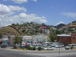
Nogales, Mexico and Nogales, Arizona adjoin one another, but are separated by a border and a border fence, as the photo shows. The journey began on a hot summer day (114 degrees when the riding started around 2 pm in the afternoon), and riding in this heat was draining. After 3+ hours of riding on paved roads, with heat from the sun-soaked asphalt baking from below and the bright, hot sun baking from above, a flat tire greeted me and I was finished for the day. The SAG wagon arrived shortly after the flat tire and I rode the final two miles to the RV park that was our evening's camp site inside a four wheeled vehicle that, happily, required no effort on my part. A shower, a swim in the RV park's pool and I was ready for dinner and the next day.
This trip was organized by Wandering Wheels, www.wanderwheels.org, an Indiana based company that has been organizing bicycle trips throughout the United States since the mid 1960s. It hosts several short trips as well as an annual coast to coast trip traveling the well known "southern route" from the Pacific to the Atlantic. But this trip in the summer of 2004 was interestingly different, from the US-Mexican border to the US-Canadian border, through Arizona, Utah, SE Idaho, then western Wyoming and Montana, four weeks of mostly camping and covering almost 1,400 miles. Along the way, we enjoyed riding in and through Grand Canyon National Park, Zion National Park, Bryce Canyon National Park, Grand Teton National Park, Yellowstone National Park and finally Glacier National Park, as well as cities large and small, through deserts, mountains, ranch land and farms. Wandering Wheels used one truck to haul our bags, 2 vehicles where riders could be transported on long days or whenever they felt like they needed a rest and a mobile kitchen where our meals were prepared. There were about 20 bike riders in our group along with a few couples who were riding motor scooters and not following the daily bike route, but who joined us each evening for dinner, the overnight, breakfast the next day, then they were off for that day.
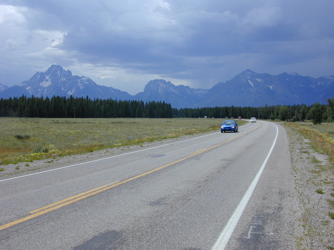
Our national parks are a real treasure and to experience them at the deliberate pace of a bicycle is like slowly enjoying a fine meal. Well, there was one exception; the road between Grand Teton National Park and Yellowstone National Park was being improved and, on the morning when I was riding it, a water truck passed by, generously spraying water to help pack the dirt. After the water truck, the road was hard, slick and wash board bumpy. Passing vehicles added to the experience, not necessarily in a positive way.
This trip was organized by Wandering Wheels, www.wanderwheels.org, an Indiana based company that has been organizing bicycle trips throughout the United States since the mid 1960s. It hosts several short trips as well as an annual coast to coast trip traveling the well known "southern route" from the Pacific to the Atlantic. But this trip in the summer of 2004 was interestingly different, from the US-Mexican border to the US-Canadian border, through Arizona, Utah, SE Idaho, then western Wyoming and Montana, four weeks of mostly camping and covering almost 1,400 miles. Along the way, we enjoyed riding in and through Grand Canyon National Park, Zion National Park, Bryce Canyon National Park, Grand Teton National Park, Yellowstone National Park and finally Glacier National Park, as well as cities large and small, through deserts, mountains, ranch land and farms. Wandering Wheels used one truck to haul our bags, 2 vehicles where riders could be transported on long days or whenever they felt like they needed a rest and a mobile kitchen where our meals were prepared. There were about 20 bike riders in our group along with a few couples who were riding motor scooters and not following the daily bike route, but who joined us each evening for dinner, the overnight, breakfast the next day, then they were off for that day.
Our national parks are a real treasure and to experience them at the deliberate pace of a bicycle is like slowly enjoying a fine meal. Well, there was one exception; the road between Grand Teton National Park and Yellowstone National Park was being improved and, on the morning when I was riding it, a water truck passed by, generously spraying water to help pack the dirt. After the water truck, the road was hard, slick and wash board bumpy. Passing vehicles added to the experience, not necessarily in a positive way.
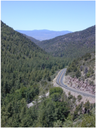
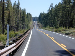
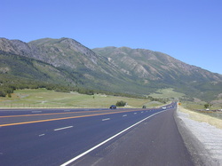
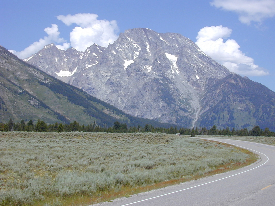
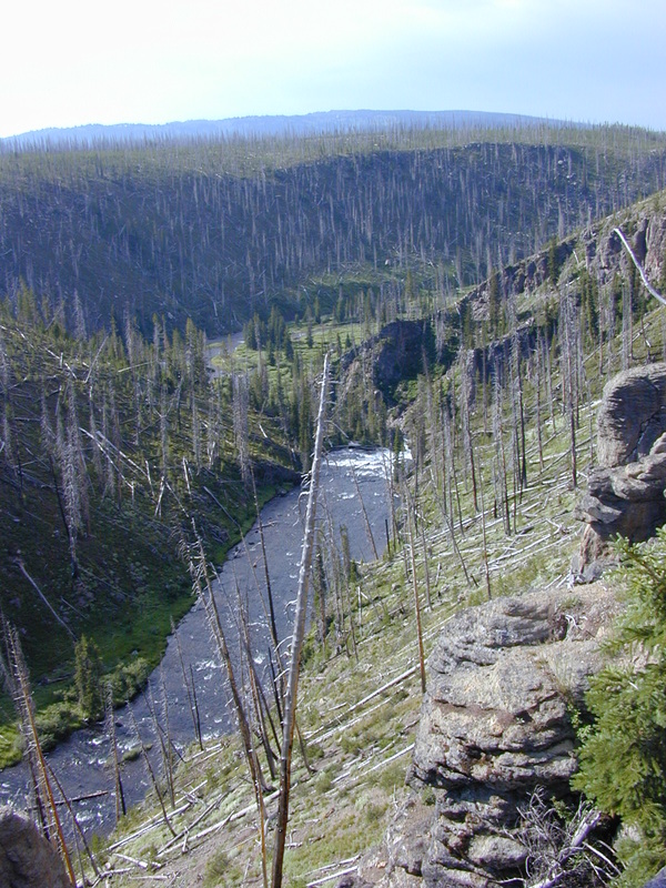
US 89/John D. Rockefeller, Jr. Memorial Parkway between Grand Teton National Park and Yellowstone National Park
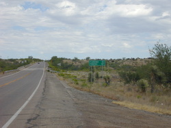
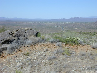
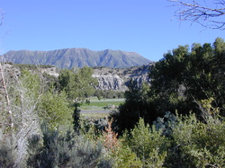
Day 1 of riding, Nogales to Amado, Arizona
I-19, north of Nogales, AZ
Leaving Nogales, Arizona, we traveled north on state roads or US Highways, built long before the Interstate era. A few miles north of Nogales, traffic was diverted onto I-19 where all vehicles were stopped and inspected by the Border Patrol. Bicycles were not inspected but the riders were questioned. Bike riding through that hot desert, 110 degrees and hotter was common during the day, one gains a deep respect for the men and women who are willing to risk their life walking through it, with little or no provisions or possessions, and hoping for a chance at a better life. As long as we have a better standard of living in the US than in Central and South America, we will have immigrants arriving and no law will "fix" that human desire for improvement of self and family. As one former Governor of Arizona famously said, "Show me a 50 foot fence and I'll show you a 51 foot ladder."
Day 2 of riding, Amado to Tuscon, Arizona
pecan orchard south of Tuscon, AZ
Day 2 began at an RV park near Amado, AZ and ended 50+ hot miles further north, in Tuscon. With temperatures above 110 degrees again today, having enough water was a major concern. Those riders carrying water in a Camelback or comparable backpack container had a distinct advantage over those riders, like me, who only had plastic bottles where water quickly turned warm, then hot in the desert sun. One more disadvantage, the capacity of 2 water bottles is much less than most of the backpack water carriers. I bought a Camelback at a bike shop in Tuscon and used it for the remained or the trip. Today's route was relatively flat, with pecan trees galore in one long stretch south of Tuscon. Riding a bike in Tuscon was a delight compared to most other American cities and towns. The roads have well marked, wide and well cared for bike lanes and the drivers are respectful of the bike riders in those lanes. Thank you citizens and leaders of Tuscon!
Day 3 of riding, Tuscon to Florence, Arizona
Today was more asphalt roads, and by now, everyone knew what that meant, hot, hot and more hot. There were a few hills leaving Tuscon, but after that, the roads were flat. Convenience stores are a welcome sight when you're on a bike because they sell those bike rider essentials like cold drinks, donuts, cookies and almost anything else you want in the way of refreshments (when burning up calories on a bike in the desert, any diet can happily be abandoned without penalty). Just south of Florence, there is a small memorial to Tom Mix. Who would have guessed that in the middle of this hot, dry desert without shade trees, a few well worn bike riders would find a shady rest spot, erected in the memory of a silent screen cowboy? Today's lesson: when stopping for refreshments, do not leave your bike computer in the bright sun. I was inside a fast food restaurant for about 30 minutes and when I returned to my bike, the face of the computer was completely black! Baked by the sun. I wondered if it was finished, but by the end of the day and more careful placement of the bike in shady areas it returned to normal.
Tom Mix memorial, AZ Route 79, south of Florence, AZ
Day 4 of riding, Florence to Wickenburg, Arizona
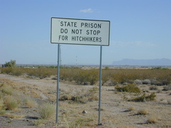
Today was one of those impossible to finish riding days, beginning in Florence, AZ, traveling through Phoenix and ending over 150 miles away in Wickenburg, AZ. No one completed all of those miles, and everyone was thankful for the support vehicles (air conditioned too). Shortly after leaving Florence, we entered a prison zone, which was announced by a roadside sign warning against picking up hitchhikers. No one in our group noticed any hitchhikers that day. During this ride, I decided to leave the planned route and visit my sister-in-law, Dode Wright, who lived on the south side of Phoenix. When I was a few miles from her house, but still on the route, I encountered a couple of other riders who were out of water. With my Camelback almost full of water, and thinking I was close to Dode's house, I generously shared my water with two thirsty riders. My mistake. I was over 20 miles away from my destination (Phoenix is really big and spread out) and ran out of water long before getting there. I saw a new fire station on the southeast side of Phoenix and thought I could get a refill there. No such luck. It may have been a change after the 9/11 attacks or some other reason, but the station was locked up tighter than the proverbial drum and I could not get anyone to answer my pounding at the door. Those last few miles in the heat and traffic were very hard, especially when you're out of water in the 100+ degree Arizona sun in late June.
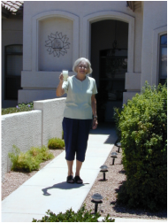
Dode's very welcome lemonade greeting
Day 5 of riding, Wickenburg to Prescott, Arizona
Halfway up Yarnall Hill, looking towards Congress, AZ
Today we went from Wickenburg to Prescott on US 89 and began encountering the mountains of northern AZ. On a positive note, that means cooler temperatures. Hooray! About 15 miles northwest of Wickenburg, we passed through the town of Congress and, after Congress, we were told that "Yarnall Hill" would need to be climbed, all 9 miles of it, so we should stock up on snacks and drinks before the hill. Well, Congress had nothing to offer in the way of food or drinks. Zilch. And as for Yarnall Hill, it was more like a long, giant mountain to this thirsty bike rider. I stopped for lunch at a place called Grandpa Jack's, which was recommended by the owner of the first convenience store I found at the top of Yarnall Hill. Very good food! During lunch, I listened to the locals talk about cows wandering the roads at night, especially black ones, and how dangerous it was to be driving after dark in a particular area. One of the locals knew the rancher and said his cows were always getting out at night. Another said that a small cattle guard could be jumped by a smart cow and this rancher needed a bigger cattle guard. That talk only reinforced my opinion that there is a whole lot more to ranching than this city boy will ever know.
Tonight, we stayed in a motel in Prescott, AZ and ate at an all-you-can-eat buffet restaurant. That restaurant had to lose money on a group of hungry bike riders. I was becoming quite good, and fast, at setting up my tent, rolling out the sleeping bag and settling in for the night. But, a real bed inside a motel was a nice change.
Tonight, we stayed in a motel in Prescott, AZ and ate at an all-you-can-eat buffet restaurant. That restaurant had to lose money on a group of hungry bike riders. I was becoming quite good, and fast, at setting up my tent, rolling out the sleeping bag and settling in for the night. But, a real bed inside a motel was a nice change.
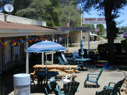
Grandpa Jack's, Yarnall, AZ where they make a great cheeseburger
Day 6 of riding, Prescott to Cottonwood, Arizona
Mt. Mingus, almost to the summit
Today we covered about 50 miles on US 89. The morning temperature was below 70 degrees and it never got uncomfortably hot during the ride. After a short warm up, we entered the Prescott National Forest and began climbing. The highest peak we crossed, Mt. Mingus, was over 7,000 feet. Welcome to the mountains! Coming from Indianapolis, elevation about 800 feet, and even with my training, it was hard to build up the lung capacity to handle these heights, so I walked a good deal of Mt. Mingus, just as I had walked Yarnall Hill on the prior day. While walking along the Mt. Mingus roadway, I passed a man from Michigan riding one of those very big, and very heavy, Harley Hogs. He had stopped to admire the scenery and his "bike" fell over in the soft gravel beside the road. We were on a steep incline to boot. He could not lift it alone, so I added my shoulder to the effort and the two of us finally got our footing secure enough to lift that Harley Hog upright. He appreciated the help and left on his extended journey around the southwest before returning home.
The real benefit of every climb, and the greater the climb, the greater the benefit, is a whee-of-a-time downhill. Mt. Mingus provided one into Jerome, AZ. Jerome is a former mining town, now a tourist destination, with many choices for eating, souvenir buying and window shopping. I found a great place for lunch on the side of the mountain (which meant a nice downhill ride/coast after a full lunch). One could see great distances on the side of this mountain and we watched a major forest fire burning across the valley, in the area of Sedona, AZ.
The real benefit of every climb, and the greater the climb, the greater the benefit, is a whee-of-a-time downhill. Mt. Mingus provided one into Jerome, AZ. Jerome is a former mining town, now a tourist destination, with many choices for eating, souvenir buying and window shopping. I found a great place for lunch on the side of the mountain (which meant a nice downhill ride/coast after a full lunch). One could see great distances on the side of this mountain and we watched a major forest fire burning across the valley, in the area of Sedona, AZ.
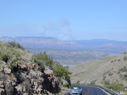
major forest fire east of Jerome, AZ
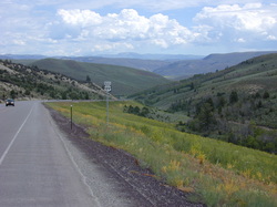
Day 7 of riding, Cottonwood to Flagstaff, Arizona
Rt. 89, north of Sedona, AZ
Today's route passed through Sedona on our way to Flagstaff, AZ, about 35 miles total riding. The Red Rock Canyon of US 89 heading north out of Sedona is a very narrow, but a very scenic, two lane road. If you're in a car and better yet, if you're a passenger in a car, this is a wonderful ride. But, if you're on a bicycle, that narrow road is very dangerous: it has a red rock wall on your right side, no berm and traffic on your immediate left. I elected to ride in the SAG wagon from downtown Sedona to the top of Red Rock Canyon, the smart choice. One woman in our group, a strong rider, pedaled up that narrow road. A pick up truck with two young men pulled up next to her, the passenger in that truck grabbed her backside and said "Nice A**" then drove on. As I said, that road is very narrow and there is no shoulder for a bicycle.
We also experienced some of the diversity of Arizona today. Our riding began at an elevation of about 3,000 feet, we climbed to over 7,000 feet, then back down to a plateau at about 3,500 feet and finally climbing again into Flagstaff at 6,900 feet elevation. We were long past the heat of the Arizona desert and into pine forests and cooler temperatures. Sedona is another tourist destination, so it is easy to find good choices for a hearty lunch, which is the only kind of lunch a bicycle rider wants on days where a long distance or mountains or both await.
We also experienced some of the diversity of Arizona today. Our riding began at an elevation of about 3,000 feet, we climbed to over 7,000 feet, then back down to a plateau at about 3,500 feet and finally climbing again into Flagstaff at 6,900 feet elevation. We were long past the heat of the Arizona desert and into pine forests and cooler temperatures. Sedona is another tourist destination, so it is easy to find good choices for a hearty lunch, which is the only kind of lunch a bicycle rider wants on days where a long distance or mountains or both await.
Day 8 of riding, Flagstaff to Grand Canyon, Arizona
Along US 180, north of Flagstaff, AZ
We left Flagstaff heading towards the Grand Canyon, some 50+ miles away, with our overnight destination being an RV park a few miles south of the park entrance. In northern Arizona, there were mountains to climb and downhills to enjoy, but it was more up than down today. Wandering Wheels provided breakfast almost every day of the trip and dinners most evenings. We were on our own for lunch, which was nice because it allowed each rider to travel at his or her own pace, stop whenever the mood struck you and eat as much or as little as you liked. On this particular day, we were told to stop at one of the grocery stores in Flagstaff because once we left town, there was "a whole lot of nothing" before the RV park at the intersection of US 180 and AZ 64. That was very true. At the start of the day, I was riding with a few other riders and spotted a Safeway grocery set back off the road, well hidden behind extensive landscaping. We were fortunate because this was the last grocery store in Flagstaff. Leaving Flagstaff, I saw the Museum of Northern Arizona and stopped. That stop turned into a two hour visit because the annual Hopi Market was underway. I bought a few items and would have purchased more if I had a place to carry them. One negative to bike touring is the absence of carrying capacity and worries about transporting fragile items.
Our destination today, the RV park and motel, was in a very flat, treeless, wind blowing, little vegetation area, with a generous supply of swirling dust and dirt. I passed on tent camping this evening and chose to pay for a modest motel room. At the time, I believed it to be a good choice. The next morning, when the tent campers awoke to dust covering everything, it became a doubly good choice.
Our destination today, the RV park and motel, was in a very flat, treeless, wind blowing, little vegetation area, with a generous supply of swirling dust and dirt. I passed on tent camping this evening and chose to pay for a modest motel room. At the time, I believed it to be a good choice. The next morning, when the tent campers awoke to dust covering everything, it became a doubly good choice.
Day 9 of riding, Grand Canyon National Park to Page, AZ
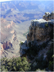
Yavapai Point, Grand Canyon
Today was Sunday as well as the 4th of July. The park was expecting a large crowd on this holiday, so we all rose at 5:30 am, ate breakfast, loaded our bikes on the support vehicles and drove the 20+ miles to the entrance of Grand Canyon National Park, arriving before 7:30 am, and, happily, before the crowd. Each member of the group was given a choice of riding from the entrance, through the park and then to Cameron, AZ, about 65 miles, of hiking in the park, then riding from the east entrance to Cameron, about 35 miles, or riding in the support vehicles all day. From Cameron, we would all ride in the vans to Page, AZ, another 80 miles away.
I opted to ride through the park, then on to Cameron. What a great day of bike riding!! Everyone would be a bike rider if they experienced a day like I had on this July 4. Riding on the paved road along the south rim of the canyon, there are numerous places you can turn off and see one spectacular view of the Grand Canyon after another. I first rode west, to the El Tovar Hotel at the edge of the canyon, then east and took every turn off possible before leaving the park at its east entrance. What a ride! After leaving the park (and this is where some in our group began their ride for the day after hiking in the park), it was 35 miles to Cameron, with almost 30 of those miles being a rapid, wind-in-your-face, exhilarating downhill ride, with a lot of coasting while watching closely for any pot holes, rocks, or other foreign objects in the road that can cause the front wheel to move in any direction other than straight ahead. At 30 to 40+ mph on a great downhill, you must keep your front wheel going straight and on the road. If you don't, the bike and rider can easily become separated and it's all bad news after that. That is the voice of experience speaking, with the scars to prove it.
Everyone in our group finally arrived in Cameron, bikes and riders were loaded in the vehicles and we rode to Page, AZ where we spent the night in a local church and were nicely fed by the minister and his wife, whose son was one of the helpers on the trip. After dinner, we saw a very nice fireworks show.
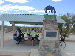
Day 10 of riding, Page, Arizona to Kanab, Utah
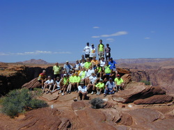
our group of bike riders & motor scooter riders
Today was a short riding day so we began by being tourists. After breakfast, the group got into the vehicles and drove to Antelope Canyon on the Navajo Reservation for some dramatic views that have been used in many TV commercials and several movies. Then we rode to a ridge above the Colorado River and everyone got a group photo. After that, we stopped by a local shopping mall where riders could buy lunch and anything else they needed. The largest houseboat I have ever seen was parked in the lot of that shopping mall (looking odd with desert all around, but Lake Powell is near and heavily used). This houseboat had a giant sign on its side advertising the sale of timeshares in this 2 story houseboat. After lunch at the mall, we were back in the vans where we rode across the Glen Canyon dam and into southeastern Utah. Our destination was Kanab, Utah, about 35 miles west. I got out at the first stop, thinking 35 miles would be easy after what we had been through. Wrong! A very strong headwind, a few hills and temperatures above 100 degrees made this short distance perhaps the most difficult day of riding. On reaching Kanab, I pitched the tent, unrolled the sleeping bag and collapsed. A short rest later, I was ready for the shower and a very big dinner in town, both of which happened.
Day 11 of riding, Kanab to Glendale, Utah, Zion NP
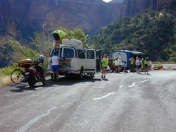
unloading bikes and riders, Zion National Park
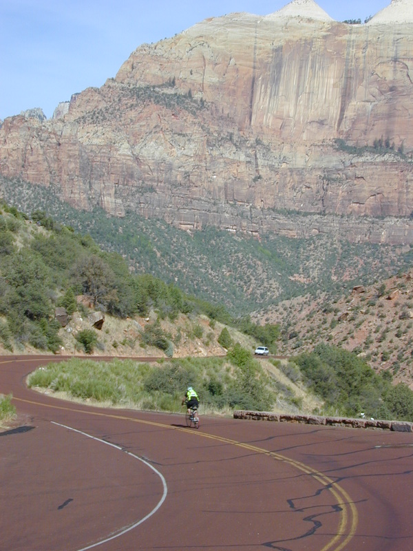
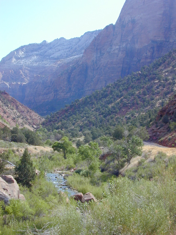
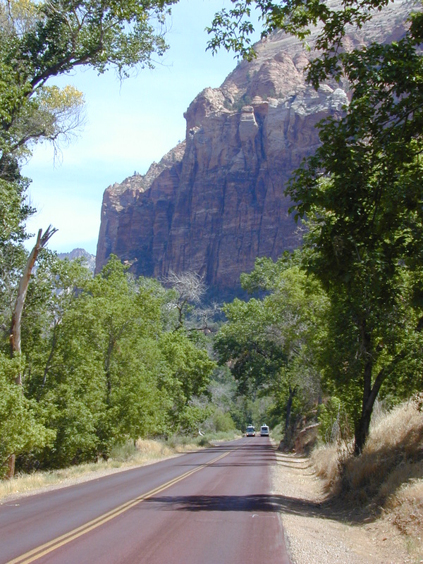
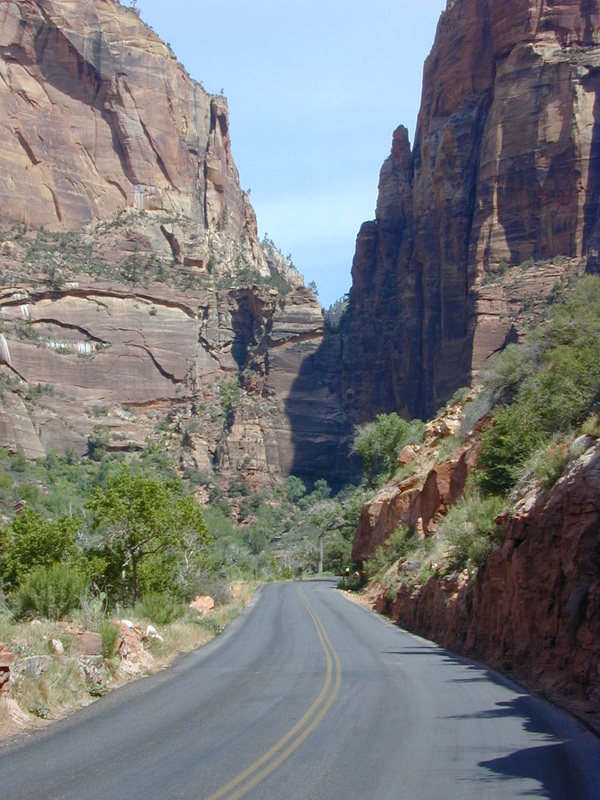
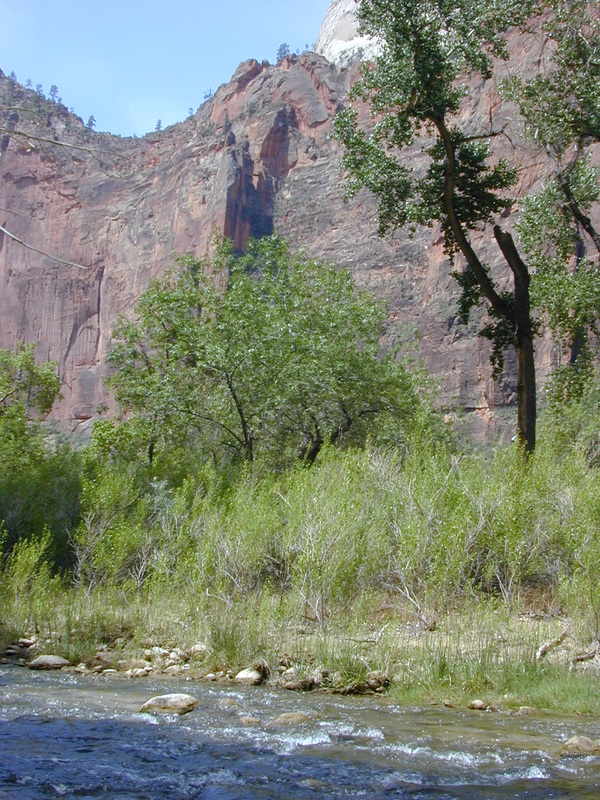
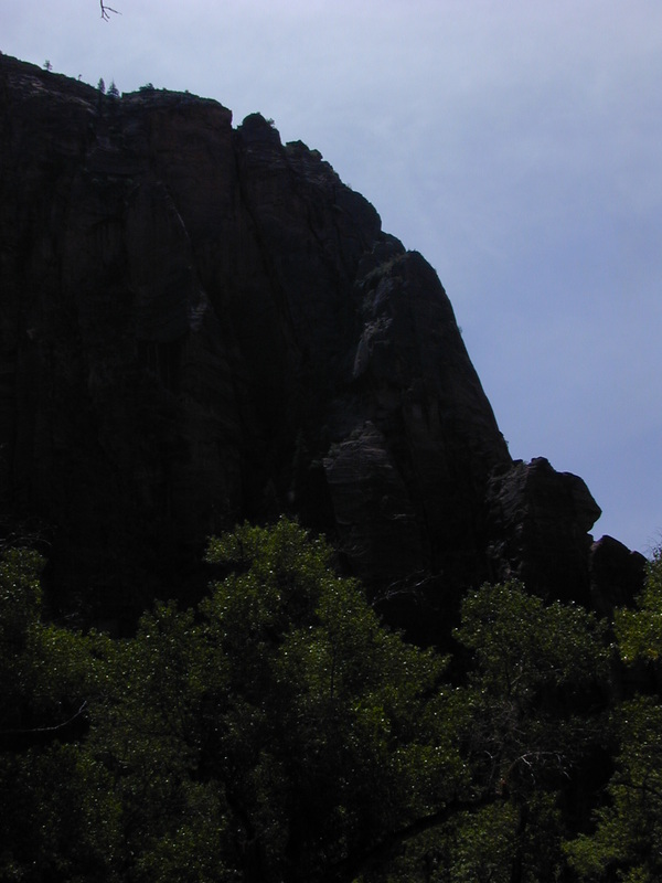
Today was another short day of riding, which was good because I was still beat from the ride into Kanab. After breakfast, the bikes and riders were loaded in the vehicles and we all rode into Zion National Park. Zion is the opposite of Grand Canyon NP in this way: in Grand Canyon NP, the roads and paths are on the canyon rim and visitors look down into the canyon. In Zion NP, the main road is at the bottom of the canyon and your views are looking up at the dramatic rock walls and scenery. Of course you can leave the main road and hike trails in both parks to get the opposite view. I only rode 20+ miles today, all inside the park, and took a few photos while enjoying a fine lunch at the Zion Lodge. Our group met at 2 pm inside the park, we loaded the bikes and riders back on the vehicles and drove to Glendale, Utah where we spent the night at a camp ground next to a stream. The cows in the nearby field added to the outdoor feel of the place. There is an extensive shuttle bus system in and around Zion NP, which makes it easy to see a great deal of that park in a short time. I should have used the shuttle bus and hiked in Zion NP instead of bike riding. The photos below were all taken on the main road through the park.
Day 12 of riding, Glendale to Circleville, Utah
road kill on US 89, north of Glendale, Utah
Last night was cool, temperature dropped into the 50s and that woke me up, searching for something warmer to put on. Cold, tired and fumbling around in a small, dark tent is not very efficient but eventually another layer of clothing was found. We're not in AZ any more!
This morning after breakfast, we loaded our bikes onto the vehicles and rode part of the way to Bryce Canyon National Park. We stopped about 17 miles from the park entrance and began riding. It was 7 to 8 hard uphill miles, followed by another 8+ miles of nice downhill to the park entrance. Along the way, I passed "road kill HQ" with more dead rabbits and one dead snake in two mile stretch than I imagined you would find anywhere.
Along the way, my camera batteries died and I did not get them replaced and the camera working until later. Too bad because the scenery, including the "hoodoos," in Bryce Canyon NP is breath taking, more so than the Grand Canyon NP, in my opinion. We entered Bryce Canyon NP at a "low point" of about 7,800 feet elevation. From the entrance to the end of the park, the road climbs to almost 9,000 feet. Bryce Canyon NP is like the Grand Canyon NP with the roads along the canyon rim and hiking trails to take you down into the canyon. As with Zion NP, there is a shuttle bus in Bryce Canyon NP and some in our group rode that bus, with their bikes on the rack in front, to the end of the main road, then coasted back down to the entrance. I was not as smart as those riders. Instead, I rode my bike to a couple of the look out points and marveled at the view. Interestingly, these two lookouts were at 8,100 feet and 8,300 feet elevation and the climb was easier than the 7,000 foot Mt. Mingus in AZ. My ability to handle the mountains of the west was improving.
After Bryce Canyon, all of us got back onto the Wandering Wheels vehicles and rode to Circleville, Utah where we spent the night camping in another RV park. Circleville claims to be the home of Butch Cassidy and, as if to prove it, we ate a very fine meal at the Butch Cassidy Restaurant.
Day 13 of riding, Circleville to Richfield, Utah
Today was a "normal" riding day, no national parks, just traveling about 60 miles along US 89, past cattle farms, along the Sevier River and generally flat riding. The day began full of clouds and it looked like we might have our first day of rain. But by the time we finished breakfast, the sky cleared and it was another great day of riding in central Utah. The temperature was in the 60s when we arose, and warmed up to over 100 degrees by noon. I continued to have camera problems and that was disappointing. Riding in the summer in the deserts of Arizona and Utah and even in the national parks and ranch lands of Utah, with temperatures regularly above 100 degrees, will naturally cause a rider to sweat. But, in that heat, the sweat evaporates almost immediately, leaving you with the salt from your sweat on your face, shirt and clothes. By the end of the day, some riders had so much salt on their faces that they had an almost ghost like appearance. The showers were even more welcome at the end of each day. Quick drying clothes were also standard for the experienced bike riders who liked to travel light, as I do. Wash them out at night and they are clean and dry the next morning, ready to go when you are.
Day 14 of riding, Richfield to Nephi, Utah
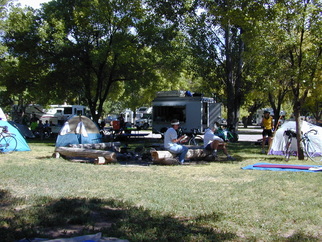
Wandering Wheels mobile kitchen in camp, bikers tents too
Today was an 85 mile day, from Richfield north on US 89 to Gunnison, then picking up Rt. 28 and taking it to Nephi, Utah, where we spent the evening in another RV park/campground. One problem with campgrounds: some folks who travel in more comfort than bike riders/tent campers, such as RV or motor home users, get up very early, say around 4 am, and seem to think that anyone in hearing distance should be up too. So, the day began earlier than intended, but it was still another great day of riding in central Utah past ranches, some large chicken farms and even a llama farm. Lunch stop was in a small town, complete with a USA Today where I got up to date on baseball scores and standings. As one would expect in a group our size, there were NY Yankee fans who joined the tour. Maybe they were there just to aggravate any Red Sox fans, but alwys in good fun. The baseball update, with current facts, was a great.
Day 15 of riding, Nephi to Salt Lake City, Utah
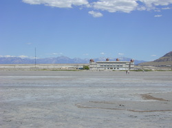
0.5 miles from the water's edge to the palace
Last night was another cold night and I woke up very cold and searched for more layers of clothing to help stay warm. I could not help but wonder (worry?) what sleeping in a tent in the Montana mountains would be like. After breakfast, we loaded all bikes and riders into the vehicles and drove to an RV park in Salt Lake City. From there, we were on our own for the rest of the day. You could swim in the pool at the RV park, ride a bus to the downtown area and walk around, or Wandering Wheels had a vehicle going out to the Great Salt Lake and you could experience that part of the state. I opted to do all of the above. First, I took a city bus from our RV park to downtown, less than 2 miles I learned, walked around the area, listened to an organ recital in Temple Square, had lunch in a food court in a downtown shopping mall, then walked back to the RV park for a swim. In the afternoon, I joined about a dozen in our group and Wandering Wheels drove us out to the Great Salt Lake. After 6 years of drought, the lake had receded; from the Great Salt Palace to the water's edge was about one-half a mile. A few short years ago, the water was up to the edge of the Palace.
The Salt Lake City Jazz Festival was being held in a downtown park that evening. Several in our group talked about going to it, but in the end, only two of us went. There were food stands all around serving a variety of dishes, good music and a chance to visit with the locals. The next morning, one of the riders in our group flew to France to see the finish of the Tour de France. Ahh choices.
The Salt Lake City Jazz Festival was being held in a downtown park that evening. Several in our group talked about going to it, but in the end, only two of us went. There were food stands all around serving a variety of dishes, good music and a chance to visit with the locals. The next morning, one of the riders in our group flew to France to see the finish of the Tour de France. Ahh choices.
Day 16 of riding, Salt Lake City to Ogden, Utah
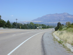
US 89, Bountiful, Utah
The RV park in Salt Lake City was near railroad tracks. Salt Lake City must be the train horn tooting, whistle blowing capital of America because we heard trains all night long. That meant very little sleeping in the tents near the tracks. Why they turned silent at daybreak is one of life's mysteries. After breakfast, several of us went to a 45 minute rehearsal by the Mormon Tabernacle Choir, which was very nice. After that, I went to the downtown Catholic church for the morning mass and then began the ride to Ogden. Leaving the church, I asked 3 different people how to find my way back to US 89. Each one was a visitor from out of town and no one knew. Not the first time that's happened and probably won't be the last. I evenrually found US 89 and looked for a fast food restaurant, where I could change into my riding clothes and get some refreshments. I was almost all of the way out of Salt Lake City before one appeared. The remainder of the day was spent riding on the east side of the Great Salt Lake, through one city after another. Fortunately, the road was relatively flat, the shoulder was generous and traffic was light on this Sunday. The temperature was in the 90's, which made tonight's RV park and its pool very welcome.
Day 17 of riding, Ogden to Logan, Utah
US 89 between Ogden and Logan, UT
Leaving Ogden, you enter a nice valley full of fruit farms. I bought tart cheeries, Bing cheeries, apricots and peaches. Later, when I caught up with some others in our group, we all enjoyed some really great fresh fruit, juicy, sweet and tasty. We then began climbing over a mountain range, with a 7 mile uphill climb and a downhill run of about 5 miles, taking us into the next valley. At the bottom of this downhill run was a fast food restaurant where I caught up with our fastest riders, who were finishing lunch. After lunch, it was on to Logan and another RV park for the evening. Today's temperature started around 60 degrees, then rose to above 100 for most of the day, at least during the riding time. When we got to Logan, and after dinner, several of us went to a local movie theater, as much for the air conditioned comfort as the movie.
Day 18 of riding, Logan to Garden City, Utah
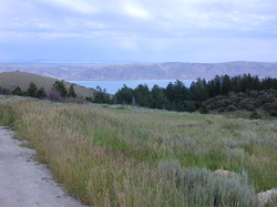
US 89, Bear Lake in the distance
Logan, Utah is the home of Utah State University, which means there are bookstores all around, with a wide selection of books. The two books I brought with me were finished, so I stopped for a long visit while selecting my future reading "assignments" at a large bookstore. The ride from Logan to Garden City is full of great scenery; mountains full of trees, a river next to the road and one post card photo opportunity after another, but it comes with mountains to climb, followed by downhill runs to enjoy, them more climbing, etc. That last crest, looking at Bear Lake and Garden City, was the beginning of a great 6 mile downhill ride into town. On the way down, I stopped for a photo and shortly after taking the picture on the left, a coyote crossed the road in front of me. A well maintained bicycle makes very little noise when it's moving, so I was almost on top of that coyote before he saw me. Both of us were surprised at this meeting. Coyote's can accelerate quickly.
Day 18 alternative riding option
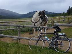
US 89, between Logan and Bear Lake, Utah
On one of the many long uphill climbs of day 18, I passed a ranch with a couple of horses inside a fence. The brown and white one looked at me for the longest time (I was only too happy to stop and rest, while talking to the horse). I thought a photo of the horse and my bike would show a contrast in modes of transportation in the west. Well, when I left the road and put the bike next to the fence, the horse looked away and would not face me or my bike. I tried talking, then out waiting the horse, but failed. So, I reluctantly took this photo of the horse and his protest to me or my bike or both.
Day 19 of riding, Garden City, Utah to Thayne, Wyoming
US 89 in SE Idaho
Today was "3 state day" because we began the day at Bear Lake, Utah, rode into southeastern Idaho and ended our day at an RV park in Thayne, Wyoming, almost 90 miles away. After about 30 miles, I stopped at a convenience store in Montpelier, Idaho for a snack. While sitting at a table and writing post cards to grandchildren, one of the locals asked if I was part of the group biking from Mexico to Canada. [A bike rider with 2+ weeks of road and camping wear is obvious, I guess.] Said he heard about our group on the radio. We had a nice visit, which served to remind me how fortunate we riders were and how others would like to participate in a trip such as this, but work, family or other obligations keep them from being able to join. A history teacher once defined a free man as someone who could choose and act on those choices. We bike riders were more free than many of the people we encountered on this trip.
I stop to read the different historical markers along the roads, and in Montpelier, they have one recording Butch Cassidy robbing a local bank. It did not say whether he was a Mormon. All of the other historical markers in that corner of Idaho tell something about the Mormon migration west in the 1800s.
I stop to read the different historical markers along the roads, and in Montpelier, they have one recording Butch Cassidy robbing a local bank. It did not say whether he was a Mormon. All of the other historical markers in that corner of Idaho tell something about the Mormon migration west in the 1800s.
Day 20 of riding, Thayne to Wilson, Wyoming
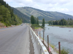
US 89 along the Snake River, Wyoming
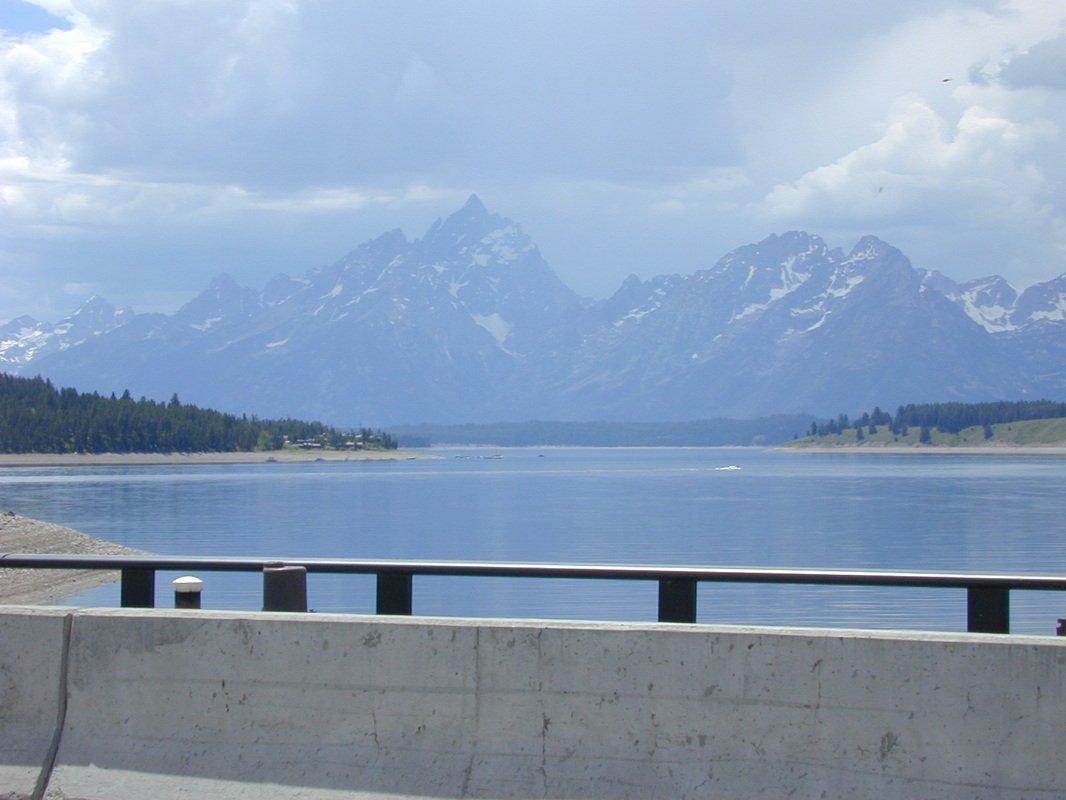
Today we rode a little more than 70 miles, starting in Thayne, riding north on US 89 through the Star Valley, which is 2 to 10 miles wide in different places and full of grain farms and cattle ranches, with a gorgeous mountain backdrop on both sides of the valley. We then turned east and rode along the Snake River (where the road was under construction, adding another hazard to bike riding) and finally turning north and ending in the small town of Wilson, Wyoming, situated in Jackson Hole. US 89, along this part of the Snake River, is referred to as the Grand Canyon of the Snake River and the views in that 10 to 15 mile stretch are spectacular, with boaters on the Snake River adding a new element to the scenery. Today was "rain day" as it rained through the night, began raining very hard around 5 am and was raining when we began riding and continued through the early part of the day. Arriving in Wilson, Wyoming, we spent two nights camping in an RV park. I thought about getting a motel room and sleeping in the same comfortable bed for two consecutive nights, but all of the hotels and motels in Jackson Hole were some distance from the RV park and I did not want to spend the time or energy trying to find one with affordable space, then moving all of my "stuff" from the RV park to the hotel or motel. So, like everyone else, I camped out for the next two nights in Jackson Hole, Wyoming. The views of the surrounding mountains were spectacular!
Day 21, Jackson Hole, Wyoming. No riding planned.
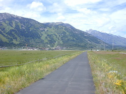
Bike path, Jackson Hole. Ski resort ahead
It was cold last night, low 40s temperature, and another scramble for added clothing in the small dark tent. I suspect that the remaining nights will be like this one. We were all on our own today, with the only planned activity being a raft trip down the Snake River at 2 pm for anyone who wanted to go. We were told where the outfitter was located and left to decide if we wanted to join the trip. I rode along the bike path by our RV camp to the Jackson Hole ski resort area. Lots of expensive items for sale there, along with expensive condominiums for sale or rent, by the weekend, week or longer. That evening, I learned that you could ride the ski lift to the top of the mountain, then pay someone with one of those parasails to hook you to him and "fly" double down the mountain. I did not know that was an option, so I did not do it on my only chance. After leaving the ski resort area, I rode my bike into Jackson. It is an unusual tourist town because of the large number of high quality art galleries, full of very nice western art. I walked into a dozen shops, looked and admired much, bought nothing. After lunch, I met up with those in our group who were rafting and we floated down the Snake River, going the opposite direction of the route we covered by bicycle the previous day. After the raft trip, it was time for dinner. Those who had taken one of the Wandering Wheels vehicles into Jackson had a wide range of dinner choices, with a comfortable van ride back to the RV park after dinner. Because I had ridden my bike into town and did not want to be riding on the narrow road to the RV park after dark, I was limited to restaurants with quick seating and fast service. I found a Mexican restaurant that met both of those conditions and, as a bonus, a baseball game was being shown on television. I had not seen a baseball game since this trip began. The Colorado Rockies seem to the "local" MLB team in western Wyoming. I only rode 20 miles around Jackson Hole on our rest day. After three weeks of riding, this was the longest bike trip I had ever been on and, frankly, was getting tired of living out of a tent. But, I was also excited about experiencing the sights, people and mountains of Wyoming and Montana that lay ahead.
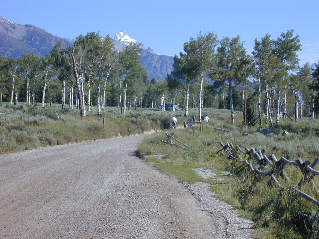
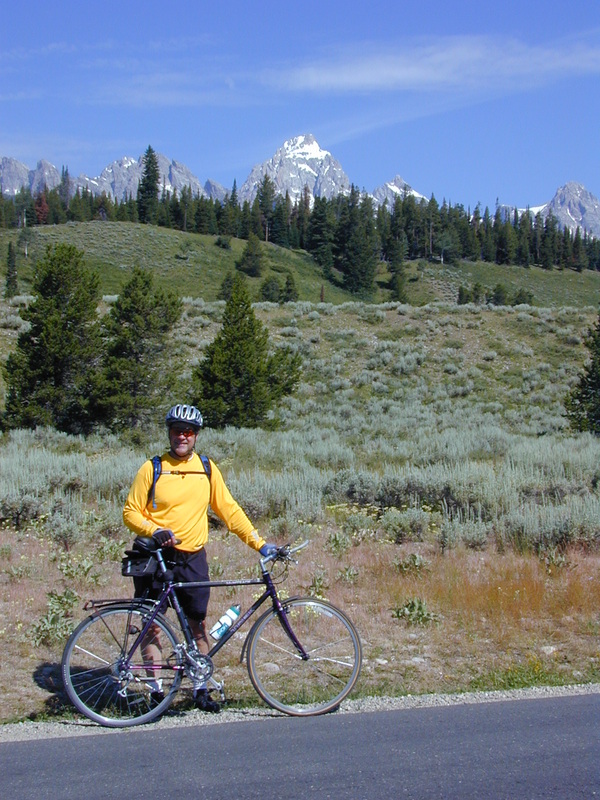
Day 22 of riding, western Wyoming
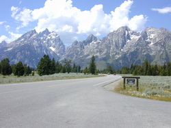
Teton Park Road, Grand Teton NP
Hard rains and strong winds during the night, and it's really nice when your tent remains dry inside. The rain was over by breakfast and we had clear blue sky for the remainder of the day. After breakfast, we headed north out of Wilson, riding through Grand Teton National Park, but stopping, hiking, photographing, and eating where ever you wished. The photos below were taken inside the park. On leaving the park at its north entrance, our destination was the south entrance to Yellowstone National Park. Before Yellowstone NP, we stopped and spent the night at another campground located off the John D. Rockefeller, Jr. Memorial Parkway in a "town" called Moran, Wyoming. Aside from the campground and its facilities, I did not see any sign of a town. Maybe it was a few miles distant, over one of the mountains.
Today was a difficult riding day for me because my gears kept shifting without warning. That is a dirty trick by the bike, especially when you're going uphill. The Wandering Wheels mechanic solved my problem; a broken chain was replaced. One flat tire on the first day of riding and the broken chain today were my only mechanical problems on the entire trip. Remarkable, I thought.
Tonight, we had a new set of instructions: we're camping in bear country and your tent needs to be cleaned out of everything that attracts bears. Removing food was obvious and easy. We also learned that bears are attracted to toiletries, like toothpaste and make up. All of those items were stored in the Wandering Wheels trucks and returned the next morning. Getting into my tent that night, and looking at how thin the tent walls were gave me pause before settling in for the night. Do bears tear open tents to get to a person who smells good to the bear? Thoughts like that fill the head of a city boy on his first camp out in bear country. My second and more serious concern was when I awoke during the night and had to walk 100 yards to the campground's rest room. Without my glasses or contact lenses for this quick visit, the thought of accidentally encountering a bear made this trip one of great anticipation. As it turned out, the trip both ways was uneventful but still tense.
Day 23 of riding, western Wyoming to Montana
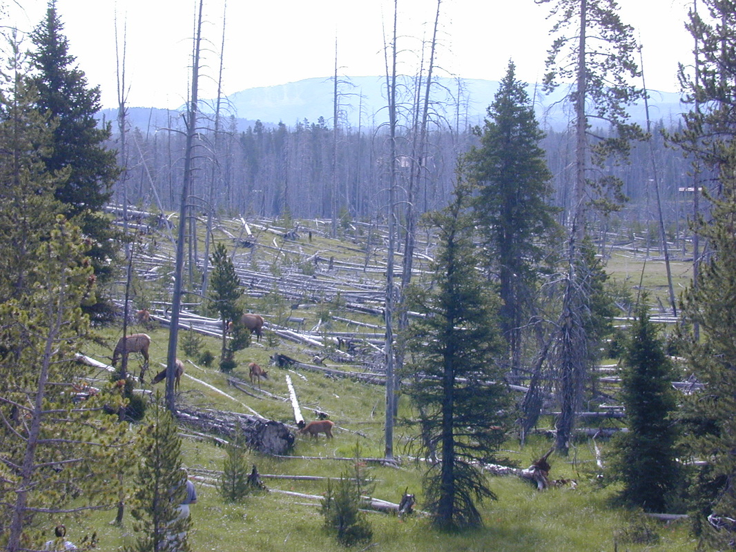
Yellowstone NP, looking towards its south entrance
There were no bear attacks during the night and breakfast in the campground restaurant was welcome. After breakfast, it was off to Yellowstone National Park on the hard pack dirt road that was in the process of being improved. If you enter Yellowstone NP at its south entrance, the road is narrow, the shoulder for bikes is non-existent and the road is up, up and more up for almost 5 miles. Fortunately, there was very little traffic at this early hour. One nice feature to entering Yellowstone NP at its south entrance: the fee paid to enter Grand Teton NP covered our entrance to Yellowstone NP as well because when you leave Grand Teton NP on the north, where we left, the only place you can go is into Yellowstone NP at its south entrance. I was thankful for small gifts.
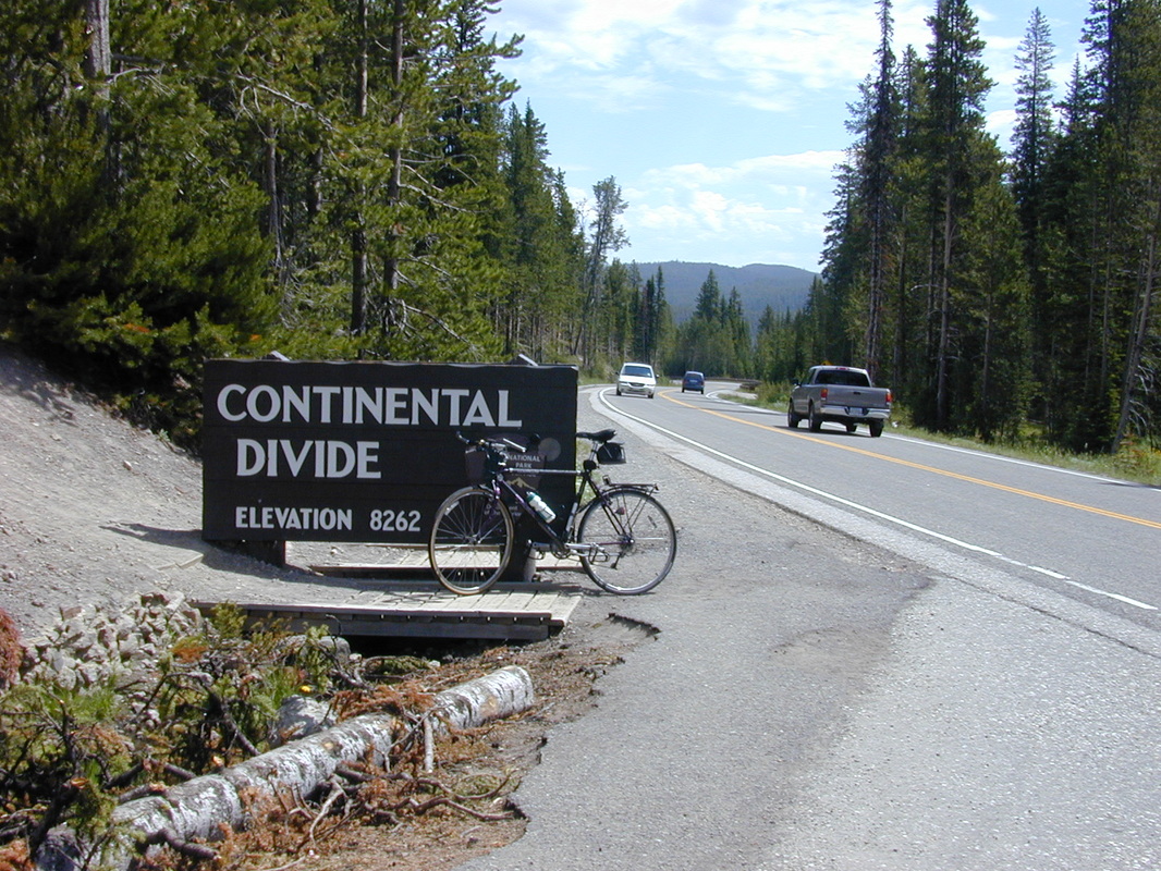
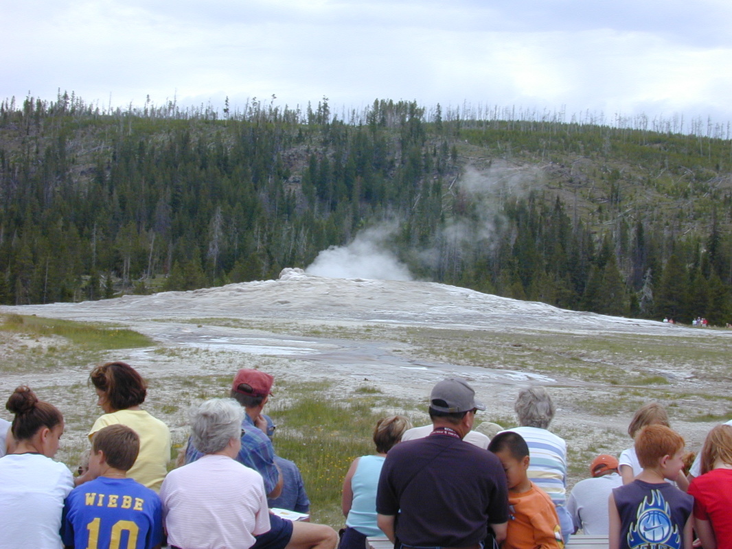
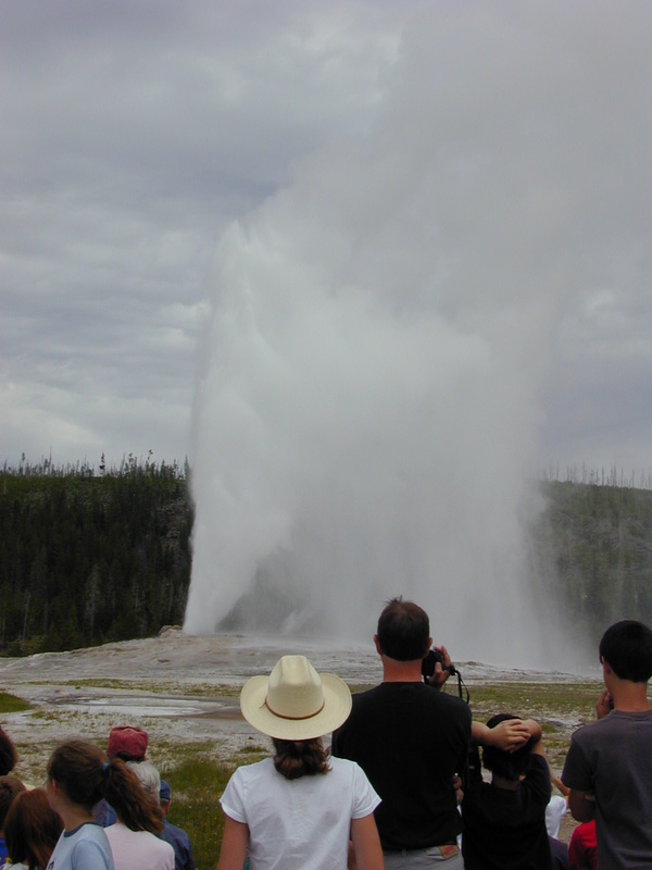
I rode my bike to the Old Faithful geyser and, if you do that, the road goes up and down, crossing the continental divide three times, each above 8,000 feet elevation. I made those climbs without difficulty, which shows my improved conditioning since the 7,000 foot Mt. Mingus in Arizona a few weeks earlier. At Old Faithful, you can watch a very good film about the park, enjoy a nice lunch and generally act like a tourist. After lunch and 43 miles of mostly of uphill riding, I chose to ride in a Wandering Wheels vehicle to our campground, which was in the town of West Yellowstone, Montana.
I rode my bike to the Old Faithful geyser and, if you do that, the road goes up and down, crossing the continental divide three times, each above 8,000 feet elevation. I made those climbs without difficulty, which shows my improved conditioning since the 7,000 foot Mt. Mingus in Arizona a few weeks earlier. At Old Faithful, you can watch a very good film about the park, enjoy a nice lunch and generally act like a tourist. After lunch and 43 miles of mostly of uphill riding, I chose to ride in a Wandering Wheels vehicle to our campground, which was in the town of West Yellowstone, Montana.
Day 24 of riding, West Yellowstone to Whitehall
Montana board meeting room, along I-90
The total distance today was about 100 miles. It rained all night and was raining still in the morning and, as if we did not have enough water, the RV park had its sprinkler system working during the night. With all the rain and standing water, the Wandering Wheels folks decided to load the bikes and riders on the vehicles and drive us about 40 miles, to Ennis, Montana. When we arrived in Ennis, the rain had stopped and several of us got out and began riding. Others decided to stay in the vans for a little longer.
The riding was what you would expect, long climbs followed by nice downhill runs, then passing through wide flat valleys full of cattle ranches and grain farms. One of the riders had a flat, which he was capable of fixing, but needed to borrow my tweezers in order to pull out a small piece of steel belting that somehow escaped from a car or truck tire and lodged in his bike tire. Shortly after that, we had some more rain. Welcome to Montana.
When I got to Whitehall, I thought riding was almost over. Wrong. The RV park could not be found. After some map double checking and looking around, I discovered it was another 6 miles further west, and the only way to reach it was to get on the interstate, I-90. Riding on an interstate highway is a mixed bag. The shoulder is nice and wide. But, it is usually sprinkled with trash thrown from passing vehicles, some of which can cause flat tires. Also, when a tractor pulling a 40 foot trailer passes at 70 mph or more, the wind disturbance is such that you must keep a constant and firm grip on your handlebars or your bike will be sent off in a new direction. Around 4 pm, I had to stop riding in order to join a board meeting by telephone. I found a nice spot by the road and it became my Montana board meeting room. Our RV park had a laundry (as many RV parks did) but it was too small for our group, so clothes washing for some riders extended well into the evening hours. The park owners also hosted an ice cream social that evening. For $1.85, it was all-you-can-eat with several flavors of very good ice cream. They may have lost money on the bike riders. Probably did not on the motor home travelers.
Day 25 of riding, Whitehall to Deer Lodge, Montana
Butte, Montana
Rain dripping on my feet inside the tent woke me with a start today. I packed away a wet tent, wet sleeping bag and wet sheet, went to breakfast provided by Wandering Wheels, then had another board meeting by telephone call from the RV park. Riding today began by going back onto I-90 for a few miles to Butte, Montana. I did not enjoy interstate riding and elected to ride in one of the vehicles to Butte, then ride my bike from there. Butte is the home of one of the world's largest open pit mines and I tried very hard to see down in it, riding around town to every high point I could get to. The mine is blocked from public view, or at least it was to me on that particular day. I rode a total of 45 miles on this day and, surprise and disappointment, we bike riders had to get back on the interstate highway in order to reach Deer Lodge. My lunch stop today was at a former gas station/convenience store/restaurant in Warm Springs. The gas pumps were long gone and the items for sale in the convenience store were modest (and that's being generous), but that did not detract from the high quality of the food. The restaurant was crowded and the food was excellent. The owner proudly wore his NY Yankee cap, which led to an enthusiastic exchange of views about baseball teams, all in good fun. We had a very strong head wind and bright sun most of the afternoon, which made the riding difficult. The good side of that strong wind and sun; in a few short minutes after reaching the RV park and getting my wet tent, wet sleeping bag and wet sheet out of the van and hung up, everything was completely dry. We were on our own for dinner tonight. Fortunately, Deer Lodge had some excellent choices and I had a very good steak dinner.
One down side to Montana; it has promoted electronic gambling so much that there is no such thing as a convenience store as we know them in Indiana and most other states. Instead, each gas station/mini grocery store is also a "casino" with a few electronic slot machines available for patrons. The oversupply of these "casinos" was depressing.
One down side to Montana; it has promoted electronic gambling so much that there is no such thing as a convenience store as we know them in Indiana and most other states. Instead, each gas station/mini grocery store is also a "casino" with a few electronic slot machines available for patrons. The oversupply of these "casinos" was depressing.
Day 26 of riding, Deer Lodge to Polson, Montana
St. Ignatius Mission Church, US 93, NW Montana
We had a slight change of plans for today, the new plan is to get to Flathead Lake, to an RV park just outside of Polson, Montana, which was about 150 mountainous and valley miles away. After breakfast, we loaded all bikes and riders into the vehicles and drove to Missoula, about 80 miles away. Those who wanted to ride their bikes from Missoula could, while others rode in the vans a little longer. The first mountain outside of Missoula had a 5+ mile climb to the summit. The other climbs that day were thankfully shorter. When we turned onto US 93, the traffic on that two lane road was very heavy and the shoulder was inconsistent; some places had a nice 4 foot wide shoulder, other places had a 2 foot shoulder, with rumble strips, which forces bicycles out into the traffic lanes, and still other parts of that road had no shoulder at all.
In a surprise, I saw a church that called for more investigation. St. Ignatius Mission Church was founded by Jesuits from Montreal in 1865. Imagine! While most of the US was being involved in or at least following the soon-to-end War Between the States, Catholic priests from Montreal, Canada were building a mission and school to bring a Christian message to the Indians of northwest Montana. This church and mission school sits on US 93, with no town in site. A few more miles north, the town of Ronan had an ice cream store which was calling out to hungry bike riders. A stop was compelled and ice cream was downed in large quantities. From there, it was another 10+ miles to Polson and our RV park for the evening. This RV park overlooked Flathead Lake and, with the mountains in the distance, we had a picture perfect camp site. Today's 70+ miles were easily manageable, no doubt as a result of my strenuous training regimen of the prior 25 days.
In a surprise, I saw a church that called for more investigation. St. Ignatius Mission Church was founded by Jesuits from Montreal in 1865. Imagine! While most of the US was being involved in or at least following the soon-to-end War Between the States, Catholic priests from Montreal, Canada were building a mission and school to bring a Christian message to the Indians of northwest Montana. This church and mission school sits on US 93, with no town in site. A few more miles north, the town of Ronan had an ice cream store which was calling out to hungry bike riders. A stop was compelled and ice cream was downed in large quantities. From there, it was another 10+ miles to Polson and our RV park for the evening. This RV park overlooked Flathead Lake and, with the mountains in the distance, we had a picture perfect camp site. Today's 70+ miles were easily manageable, no doubt as a result of my strenuous training regimen of the prior 25 days.
US 93, Flathead Lake in the distance
Day 27 of riding, Polson to West Glacier, Montana
Flathead River, near Kalispell, Montana
The temperature dropped into the 30s, but I dressed for the weather and slept right through. Today is going to be an 80+ mile day, about 50 miles to Kalispell, then another 30 miles to our RV park which is near West Glacier, Montana. I thought I was ready for it, but we began riding along the west side of Flathead Lake and the combination of head winds and a 3 mile uphill climb at the start of our journey made me wonder if I really was ready. This was a difficult day's ride, but with lots of rest breaks, I finished. A grandmother and 5 young helpers were selling Lambert cherries at a roadside stand, so I bought a 2 pound bag. I was told these only grow in Idaho and northwest Montana. Lambert cherries are like Bing cherries, only lighter in color. Those cherries got me to Kalispell, where I found a place serving large quantities of lunch food.
The last 30 miles from Kalispell were very tough: strong headwinds, narrow road and lots of traffic. In a small town, a young girl had a lemonade stand by the road. A welcome break. A few miles later, I encountered two adults who were selling Lambert cherries, and negotiating with a state road official who wanted them to move their sign; the official thought it was too close to the road. I bought more cherries and ate all of them. A little further down the road, I finally ran out of "gas." The photo of the Flathead River was taken during my rest and wait for a Wandering Wheels van to pick me up. After a wait of unknown duration, I felt refreshed and got back on my bike. It was another 10+ miles to our campground for the night and I arrived shortly before dinner. Tonight, we are staying in cabins at the campground, so no tent pitching, just roll the sleeping bag out on a wooden bunk.
That evening, while talking to some of the other riders who had been to Glacier National Park before, I learned some disturbing news. The climb to the summit on the Going To The Sun Highway is going to be more difficult than any climb that we had experienced on the trip. Most of those riders (who were stronger riders than I was) only rode 30 to 40 miles today, intending to save themselves for the ride in Glacier NP. I was looking forward to the next day's ride, our last day of riding, and this news was very disturbing. Could I make it up the mountain? If I could not, then what? The Wandering Wheels vehicles, all vans and trailers actually, are barred from that narrow, twisting road, so there would be no SAG support on the Going To The Sun Highway. All I could do now was get a good night's rest and hope that I was ready for the next day.
Day 28 of riding, Glacier National Park
bikes and riders preparing to ride
We left the campground by 6 am today, some riding their bikes the few miles to the park, while others rode in the Wandering Wheels vehicles to the park. I chose the latter. The early departure was necessary if the bike riders were to reach the summit, then descend and have enough time to meet the Wandering Wheels vehicles on the other side of the park with enough time to pack up and leave for your departure city. I was flying out of Great Falls, Montana, others were flying out of Salt Lake City and a few were riding in the vehicles back to Indiana with the Wandering Wheels folks.
Once inside Glacier National Park, bikes and riders were unloaded and the Wandering Wheels vehicles left the park and drove around to the east side, where they would meet the riders after finishing their day's ride. It was overcast and cool when we started. From our drop off point to the base of the mountain was about one mile. We then began to climb. The Going To The Sun Highway runs across the park from the southwest corner to the northeast part. We began in the southwest corner and from the moment the climbing began until we reached the summit it was 20 miles of steady climbing. There were no downhill sections where one could coast. There was not even a short flat section in that 20 mile uphill climb. No wonder the experienced riders were cautious about their riding on the prior day! There were a few places to pull off the narrow road and allow vehicles to pass, and bike riders to rest, including one where the glacier came down to the road. When I reached the summit, I found that it had a gift shop and park information, but no food! None! That is not a nice greeting to a bike rider who has just spent prodigious amounts of energy pedaling up 20 miles of steep mountainside. But, after each climb is a downhill, and the Going To The Sun Highway furnished a nice wind-in-your-face downhill ride. Along the way down, there were lodges, gift shops and places to get FOOD.
The mountains in Glacier NP are unlike any other we had seen during the past four weeks. They rise to what appears to be sharp points, so sharp that you might cut your hand if you scraped it across one of those summits.
Shortly after my lunch stop in the park, I exited it and caught up with the Wandering Wheels vehicles. Just over 40 miles of riding today, almost all in Glacier NP. Bikes and riders were loaded up and taken to whatever city they were flying out of. Wandering Wheels agreed to take my bike back to Indiana in one of its vans, which saved me from dismantling my bike, then dealing with a bike bag and the airline. A few of us had tickets leaving from Great Falls, Montana, the closest city to Glacier NP, so that's where we went. I checked into a motel for the evening and flew out the next morning to Indianapolis. The bike trip was over, but what a grand experience it was, all four weeks of it.